
Real-Time Monitoring
IoT-powered equipment, fleet, and worker monitoring for real time situational awareness.
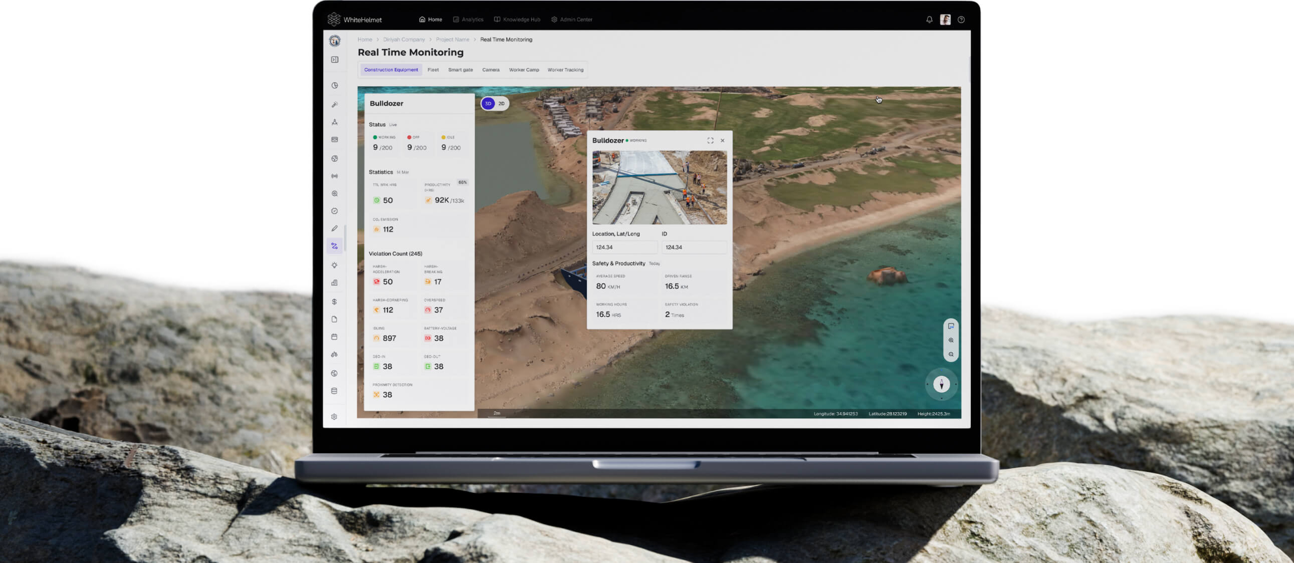
Monitor Everything on Site In Real Time.
Connect IoT sensors to track equipment health, fleet movements, cameras, smart gates, worker safety, and environmental conditions. Real Time Monitoring turns raw sensor data into dashboards for proactive site management and situational awareness.
Equipment Health Monitoring
Fleet & Vehicle Tracking
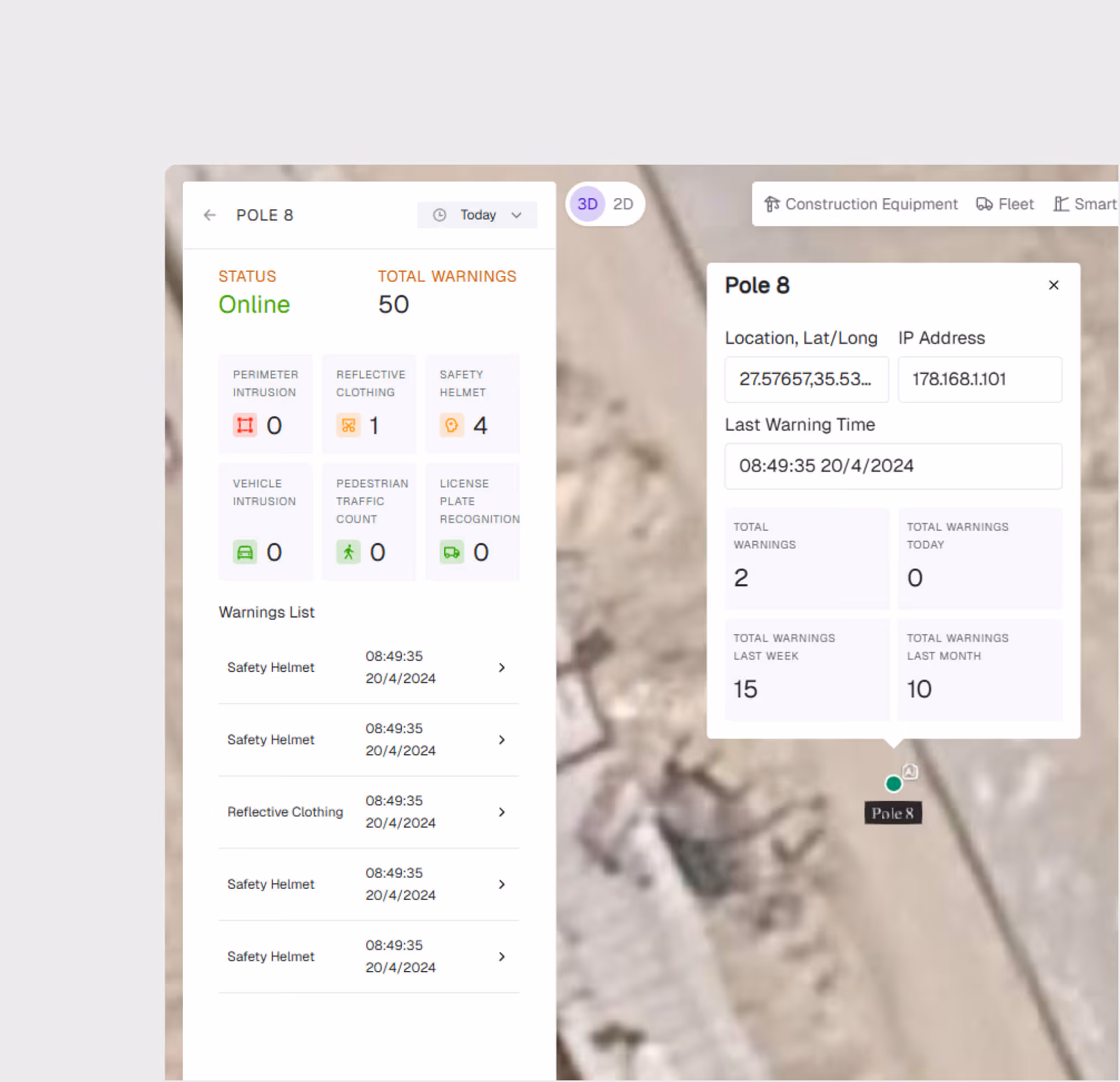
Smart Gate Access Control
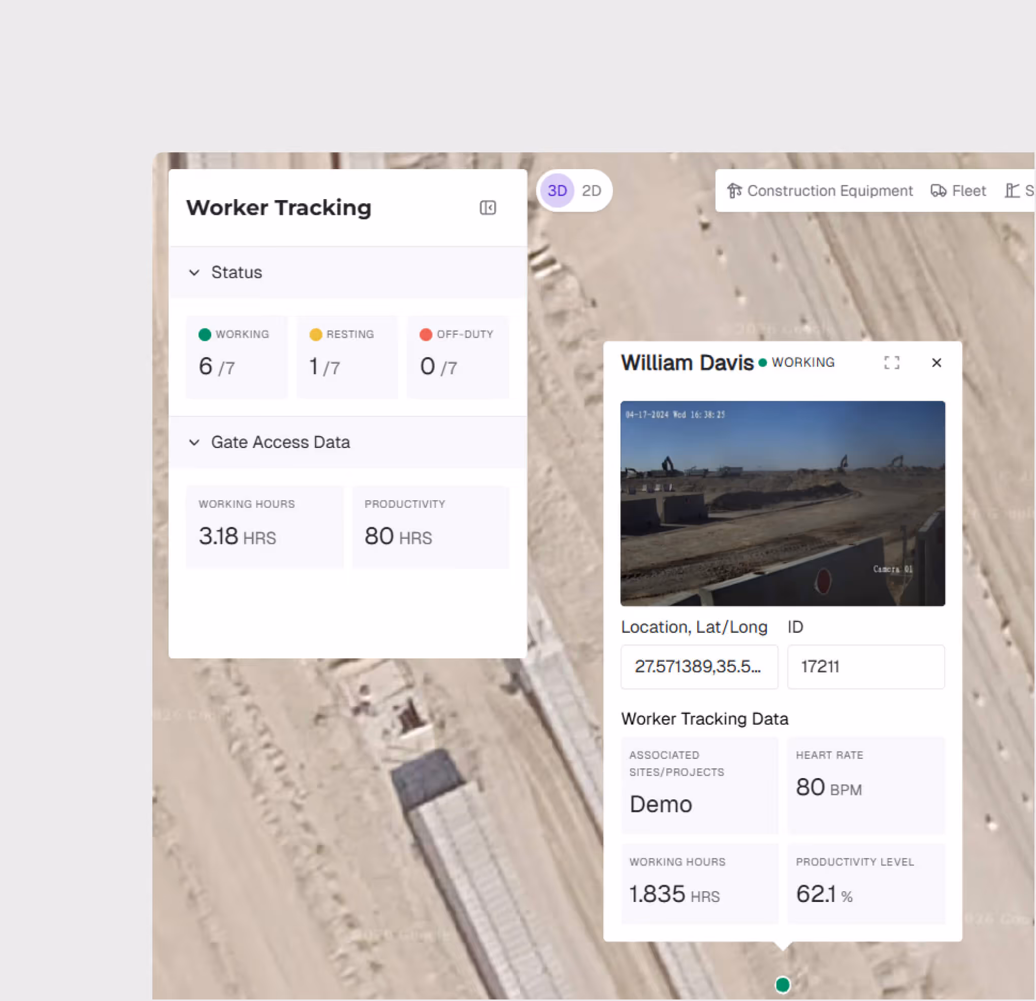
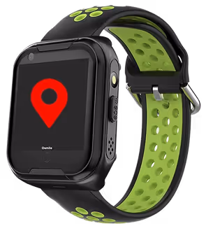
Worker Wearable Devices
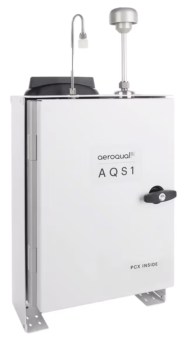
Air Quality Index Sensors
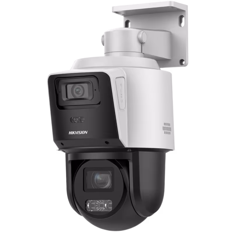
Cameras and CCTV
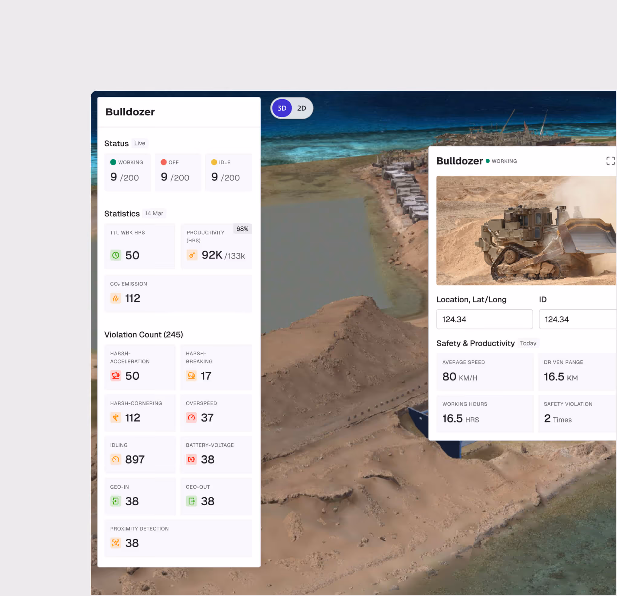
Equipment Monitoring Dashboard
Track heavy equipment utilization, engine hours, fuel consumption, and maintenance schedules. Receive alerts for abnormal operating conditions before equipment fails.
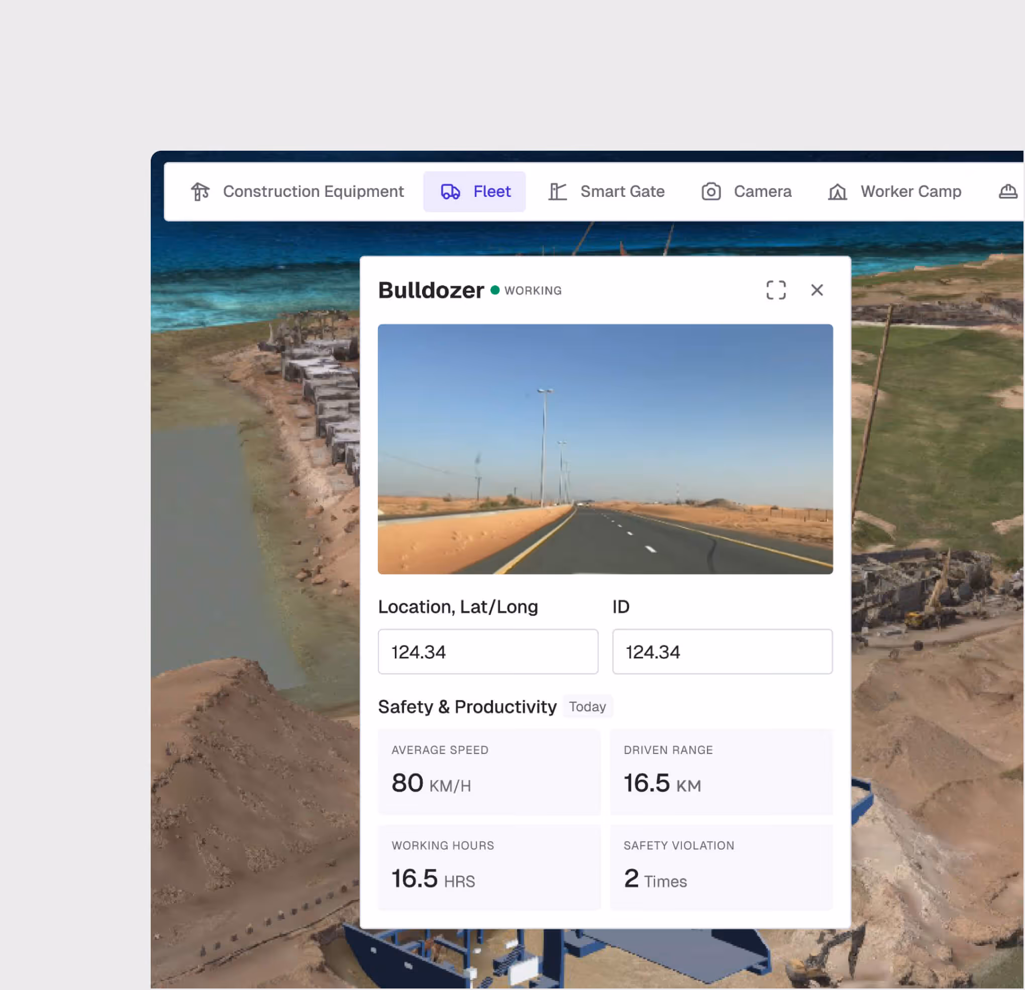
Fleet & Vehicle Tracking
Monitor all project vehicles in real time with GPS tracking, speed alerts, geofence violations, and trip history. View warning counts for fleet-wide risk management.
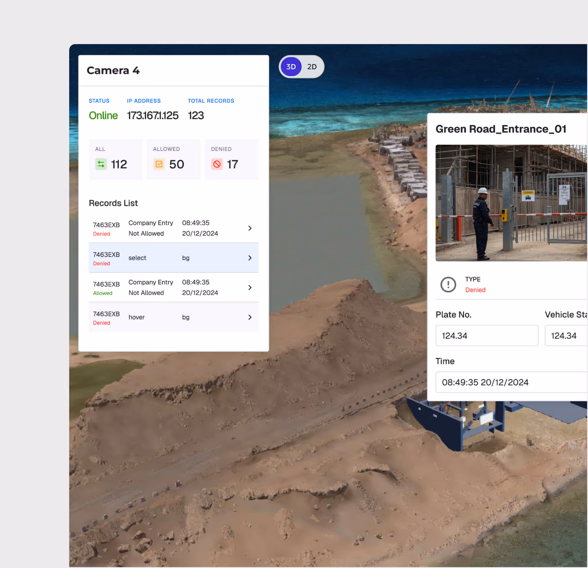
Smart Gate Management
Control and monitor site access through smart gates. Track entry/exit events, enforce access permissions, and generate attendance reports automatically.
Worker Safety Monitoring
Monitor worker locations relative to danger zones, restricted areas, and emergency assembly points. Trigger alerts when workers enter hazardous zones without authorization.
Cameras and CCTV
View site progress and conditions in real time with CCTV real time view. AI Cameras can also detect safety issues on site and log violations in a central near real time dashboard.
Real-Time Monitoring is most useful for:
Control Room Operators
Fleet, Camera, and Smart Gate Situational Awareness
Track all equipment and vehicles across the project site, optimize utilization, schedule preventive maintenance, and reduce costly unplanned downtime.
Safety Officers
Worker Safety Monitoring
Monitor worker locations in real time, enforce restricted zone access, and trigger immediate alerts when safety parameters are breached.
Site Managers
Resource Coordination
Visualize all moving assets on the project map — equipment, vehicles, and personnel — for real-time resource coordination and logistics planning.
"We aggregated all our IoT sensors in one real-time dashboard using WhiteHelmet. Executives were finally able to see there site in real time at anytime, especially critical during emergency situations"
.avif)
Frequently asked questions
Yes. All geo-tagged incidents are displayed on the GIS map, enabling spatial analysis of incident patterns and high-risk zone identification.
GIS 3D supports IFC and RVT for BIM models, LAS/LAZ for point clouds, and standard image formats for drone orthomosaics and aerial imagery.
Yes. GIS 2D and GIS 3D share the same geospatial foundation. You can switch between 2D planning views and 3D visualization views seamlessly.
When an incident is logged, the user selects the appropriate SOP-based workflow based on incident type and severity, guiding investigators through each required step.
WhiteHelmet products Real-Time Monitoring works well with

Field Intelligence

Project Management Intelligence
Tools that work alongside this product
WhiteHelmet Applications are available in both Google Play and App Store.