
AI Visual Pollution
AI-powered environmental monitoring that detects visual pollution from images automatically.
Keep your Site Clean and Safe.
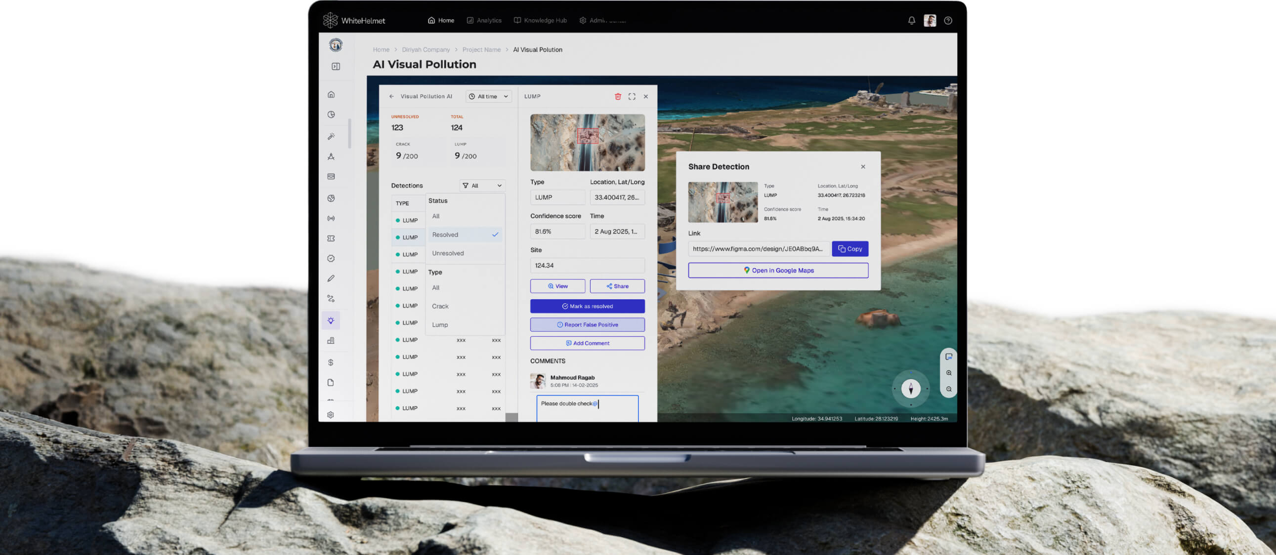
Upload drone images and let AI detect environmental pollution — waste accumulation, broken civil assets, stray animals, and construction waste. AI Visual Pollution frees manual site visit checks and allows you to optimize your resources based on real data, not randomized outsourcing.
AI Pollution Detection from Images
Multi-Category Violation Detection
Geo-Referenced Violation Mapping
Comment, Resolve, and Issue Detections
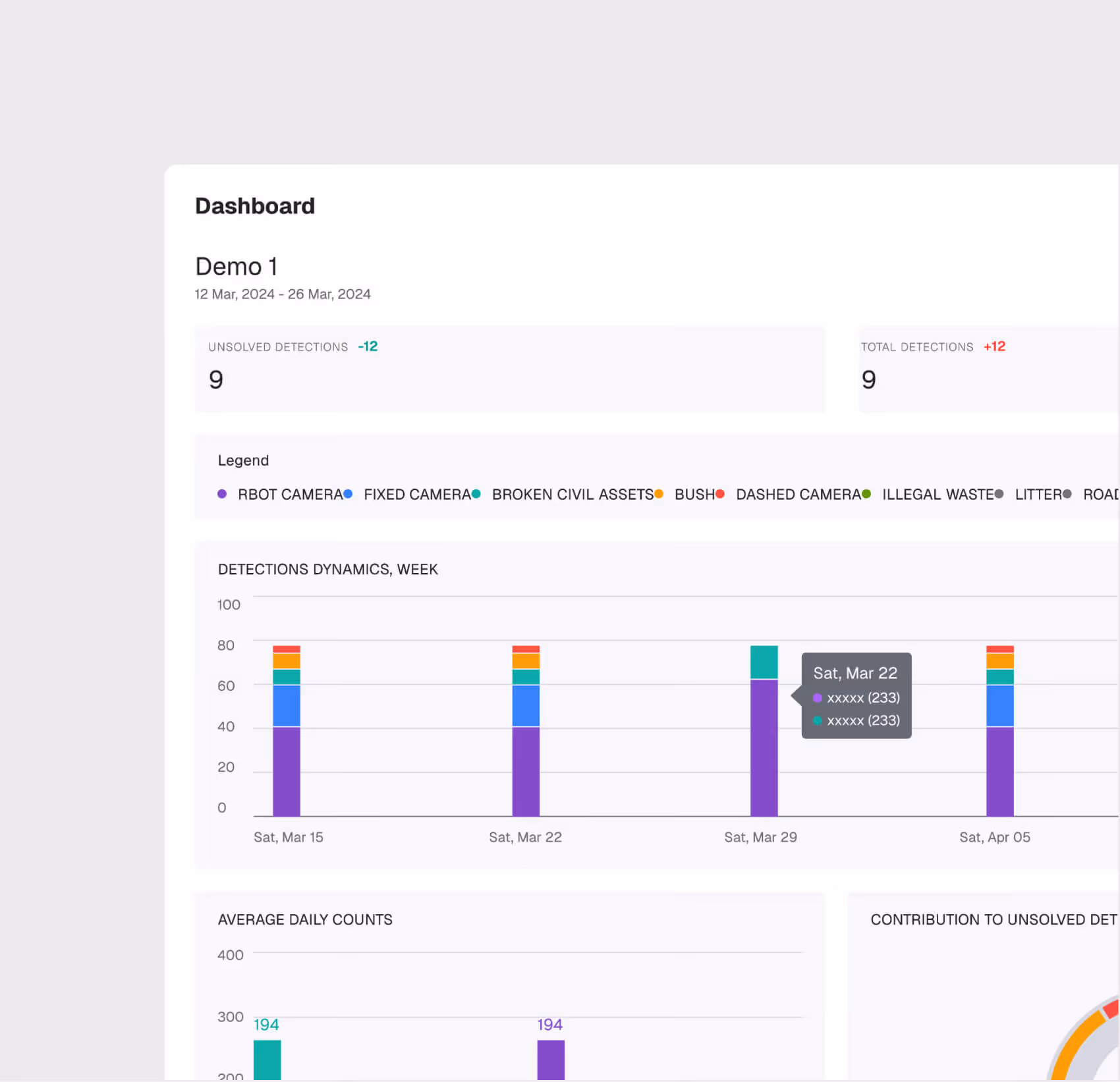
Trend Analytics & Dashboard

AI Detection Engine
Upload drone images and the AI automatically identify pollution types — waste, broken civil assets, stray animals, and construction waste — with confidence scores and bounding boxes.
Multi-Category Detection
The system recognizes multiple pollution categories simultaneously, classifying each detection by type, severity, and geolocation.
.avif)
.avif)
Geo-Referenced Violation Mapping
Detections are mapped to their spatial location on the project GIS, enabling zone-level environmental monitoring and hotspot identification.
Compliance Trend Analytics
Track pollution detection trends over time — frequency, types, zones, and resolution rates — to demonstrate environmental due diligence to regulators.
AI Visual Pollution is most useful for:
Environmental Officers
Automated Compliance Monitoring
Replace manual environmental inspections with AI-powered image analysis that monitors site conditions continuously and flags violations before they escalate.
Municipality Supervisors
Proactive Site Management
Get early warning of environmental issues that could trigger regulatory stop-work orders, allowing corrective action before inspectors arrive.
HSE Directors
Portfolio Environmental Oversight
Monitor environmental compliance across all project sites from a single dashboard, with trend data for management reporting and regulatory submissions.
"We used to deploy 14 drivers across 30 locations for site visits and manual identification of visual pollution. Now we deploy 1 pilot across 30 locations and know exactly where to focus our efforts."
.avif)
Frequently asked questions
WhiteHelmet operates globally, with active presence across the Middle East, Europe, Central Asia, South Asia, and North America.
Based on giga-project benchmarks: Field Intelligence delivers 87% time savings and up to 75% cost reduction. Project Management Intelligence saves up to 85% on weekly tasks.
Yes. You can start with a single product, expand to a phase bundle, or go straight to the full Enterprise Construction OS — all on the same platform with no re-implementation needed.
Pricing depends on company size and modules selected. We offer flexible options including individual products, phase bundles, and fixed packages — so there’s a fit for every project scope and budget.
Yes. WhiteHelmet pulls data from leading construction and enterprise platforms — so it complements existing systems rather than replacing them overnight.
Yes. WhiteHelmet’s Document Management System (DMS) is a fully built-in EDMS — supporting 30+ file types, configurable approval workflows, auto-numbering, version control, digital signatures, and SLA alerts, all within the same unified platform.

