
GIS 3D
3D construction digital twin with geospatial data, overlayed plans, and AI construction progress analysis.
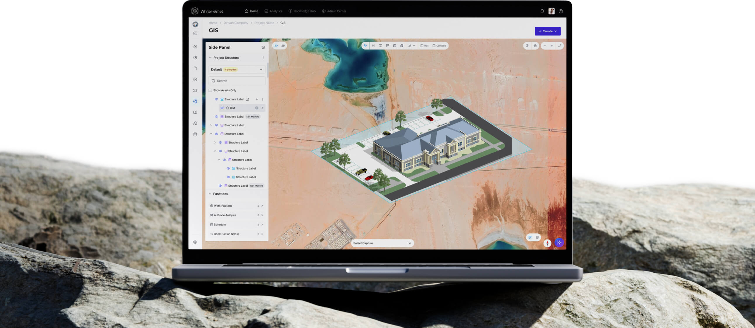
Construction Progress Digital Twin n
Combine BIM models, point cloud scans, and drone imagery on one 3D geospatial platform. GIS 3D gives you a living construction digital twin of your construction site for AI progress tracking, deviation detection, stakeholder communication, masterplan and progress overlay, and geospatial data overlay.
2D CAD, 3D BIM, Point Cloud, and 3D Reconstructed Model Rendering
AI Drone Image Analysis for Earthwork, Building, Piling Progress
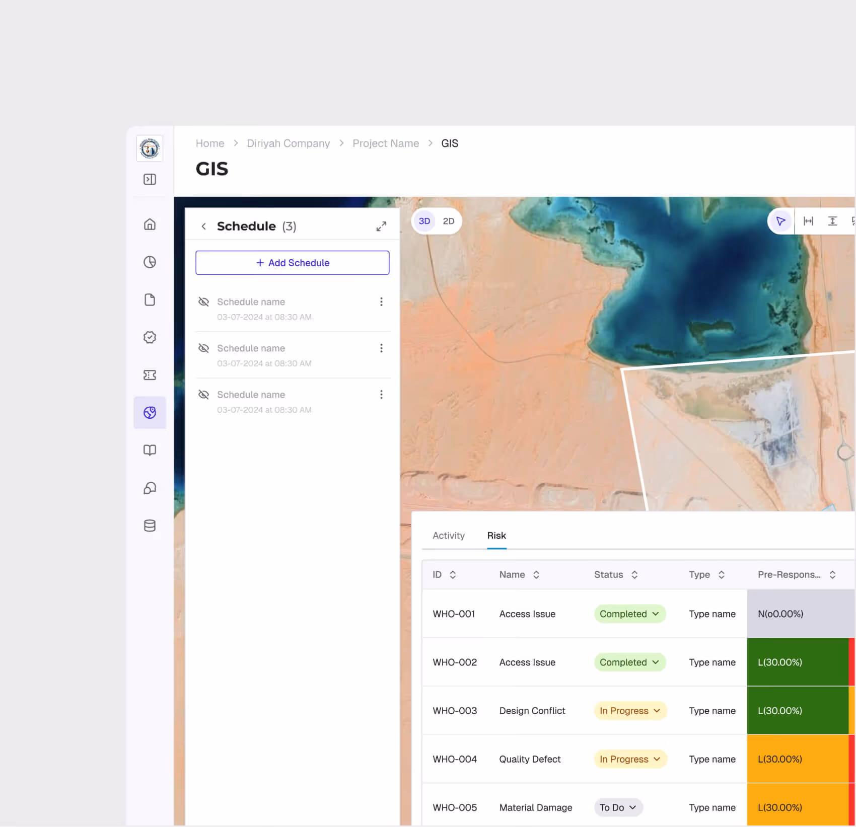
As-Built vs. Planned Comparison
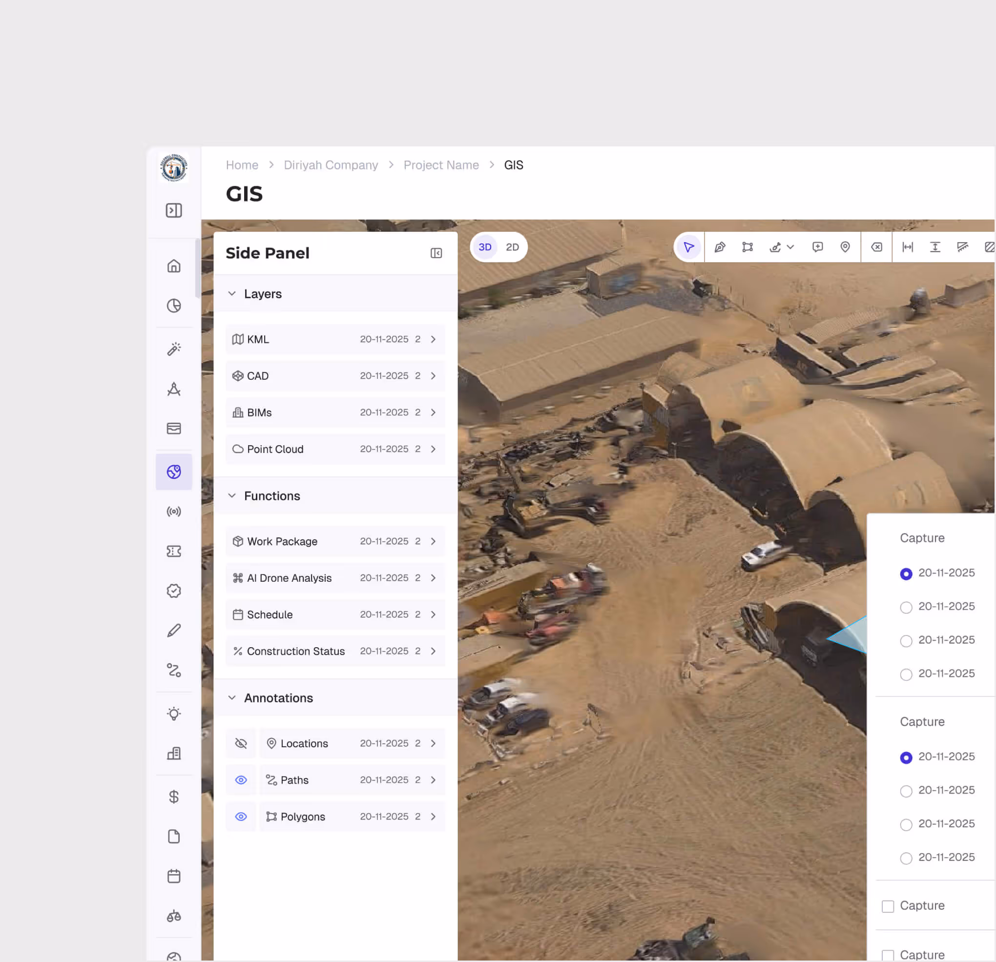
Multi-Layer Geospatial Overlay
Measure, Comment, and Track Progress Remotely
AQD Real Estate Company — Enhancing Project Transparency and Efficiency Using WhiteHelmet Solutions
.avif)

3D Drone Reality Capture
Use drones and AI to reconstruct a centimeter-level accuracy 3D model of your entire site. Measure remotely, compare captures across dates to track visual progress, and collaborate with colleagues without paper or drawings.
Multi-Layer Geospatial Overlay
Overlay BIMs, CADs, point clouds, schedules, and masterplans in one geospatial view. Pin locations with metadata, check construction status at an executive level, and anchor all project data to a single spatial source of truth.
.avif)
AI Spatial Intelligence for Progress
AI fuses GIS, drone imagery, and time-series data to quantify earthwork volumes, calculate cut/fill, and track construction progress spatially over time — turning what used to take 5 people over 5 days into a single survey by one person in one day.
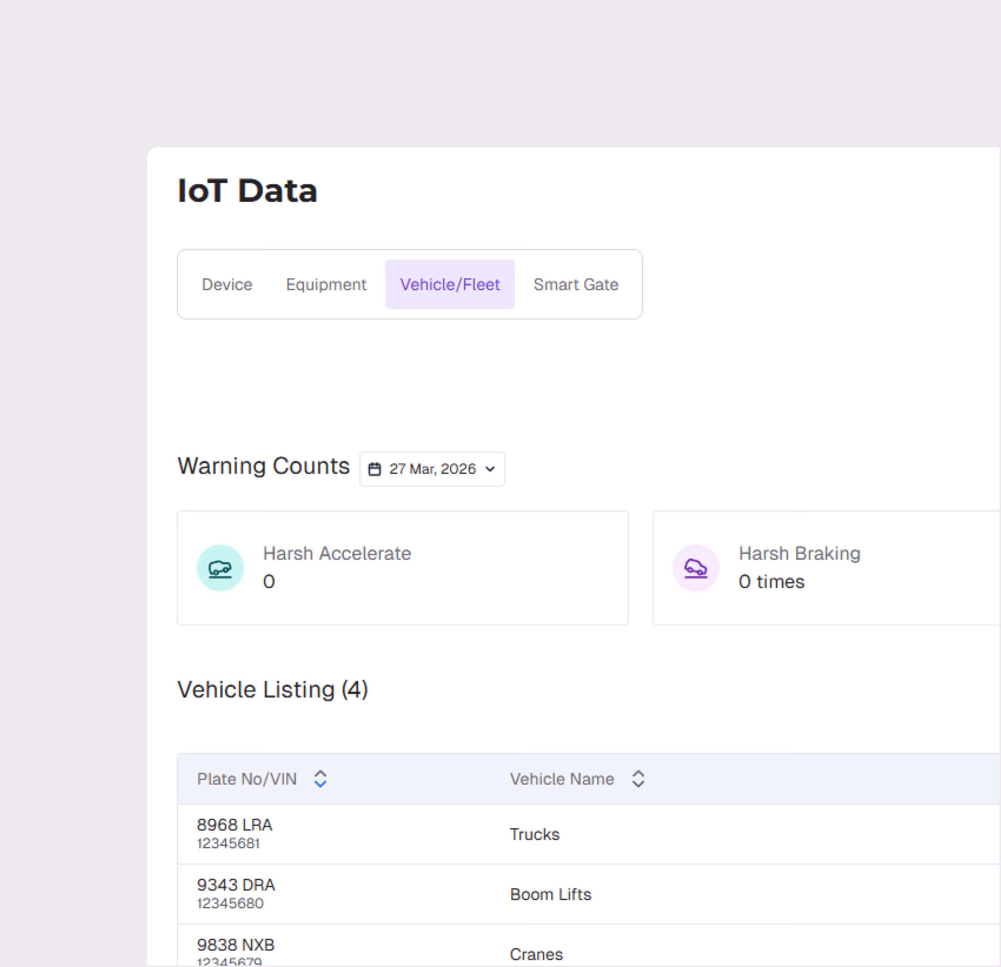
IoT Sensor Fusion
Connect gates, cameras, fleet sensors, and construction equipment to attain real-time situational awareness. AI detects anomalies and unsafe patterns from sensor and camera data, triggering spatially aware alerts and preventive actions.
.avif)
As-Built vs. Planned Comparison
Compare the 3D as-built reality capture against the planned BIM model to identify deviations, quantify variances, and track construction change over time. If a twin can’t explain what changed, it’s just visualization.
GIS 3D is most useful for:
Decision Maker
Executive Site Overview
Get a comprehensive 3D view of the entire project without visiting the site — track progress, identify risks, and communicate status to stakeholders visually.
Survey Engineers and Project Controls
As-Built Verification
Compare laser scan point clouds against BIM models to verify construction accuracy, detect deviations early, and generate precise as-built documentation.
Construction Manager and Directors
Progress Monitoring
Monitor construction progress in 3D with AI-analyzed drone imagery — see what is built, what is behind schedule, and where resources need to be reallocated.
"GIS 3D turned our weekly progress review from a guessing game with subcontractors into a data-driven conversation and approval process. This tool revolutionized our progress monitoring insights and planning decisions."
.avif)
Frequently asked questions
Yes. The system supports unlimited contracts per project, each with its own value, milestones, and approval workflows.
Claims are submitted with supporting documentation, routed through configurable approval chains, and tracked through to payment certification with full audit trail.
Yes. Role-based access allows you to grant external auditors read-only access to relevant audit records and evidence.
Each finding generates a corrective action request (CAR) with an assigned owner, deadline, and verification requirement. CARs are tracked through closure with audit trail.
The system supports ISO 9001, ISO 14001, ISO 45001, safety audits, environmental audits, and custom audit types defined by your organization.
Yes. Checklists are fully configurable by audit type, scope, and project requirements. Add custom questions, evidence requirements, and scoring criteria.
WhiteHelmet products GIS 3D works well with

Field Intelligence

Project Management Intelligence
Tools that work alongside this product
.avif)
WhiteHelmet Applications are available in both Google Play and App Store.