
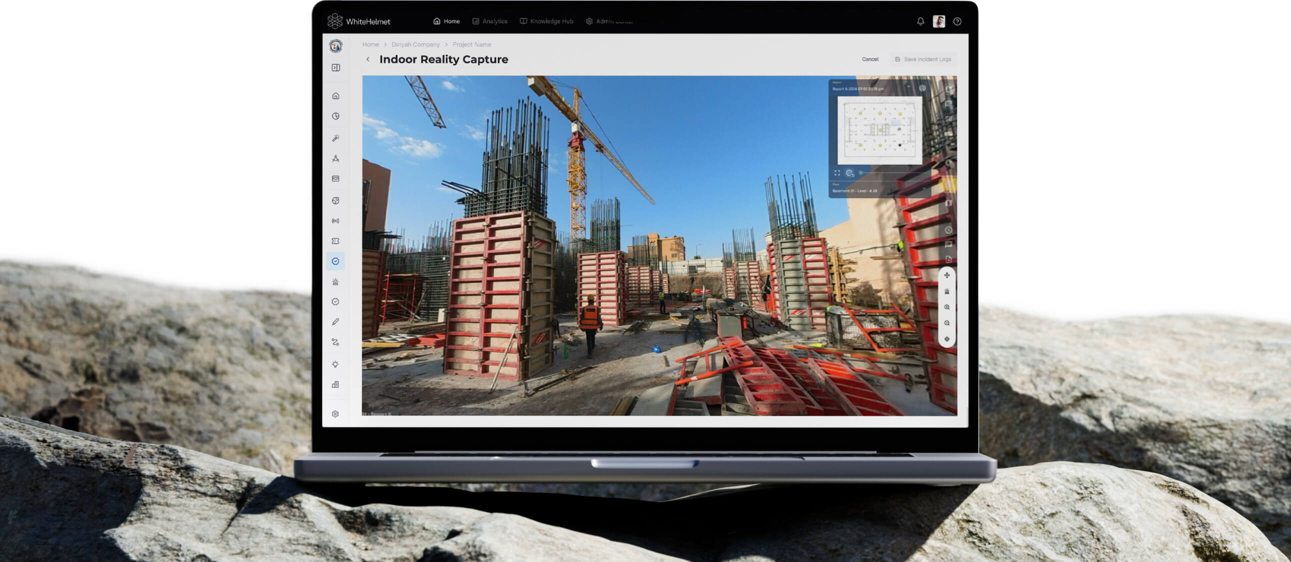
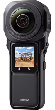
360° Reality Capture
Complete site intelligence: 360-degree reality capture with geo-tagged observation management, AI-powered progress detection, and snagging & punch list workflows — all in one platform.
Site from Anywhere. Resolve Every Issue Faster.
Capture 360-degree site imagery and log geo-tagged observations in one unified workflow. From virtual walkthroughs for remote stakeholders to structured snagging and punch list management — WhiteHelmet connects what you see with what needs to get done.
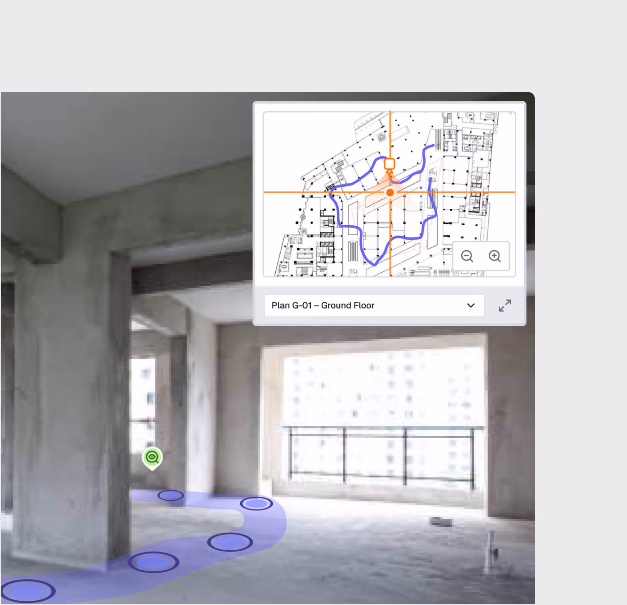
360° Site Photography & Virtual Walkthroughs
AI Safety & Progress Detection
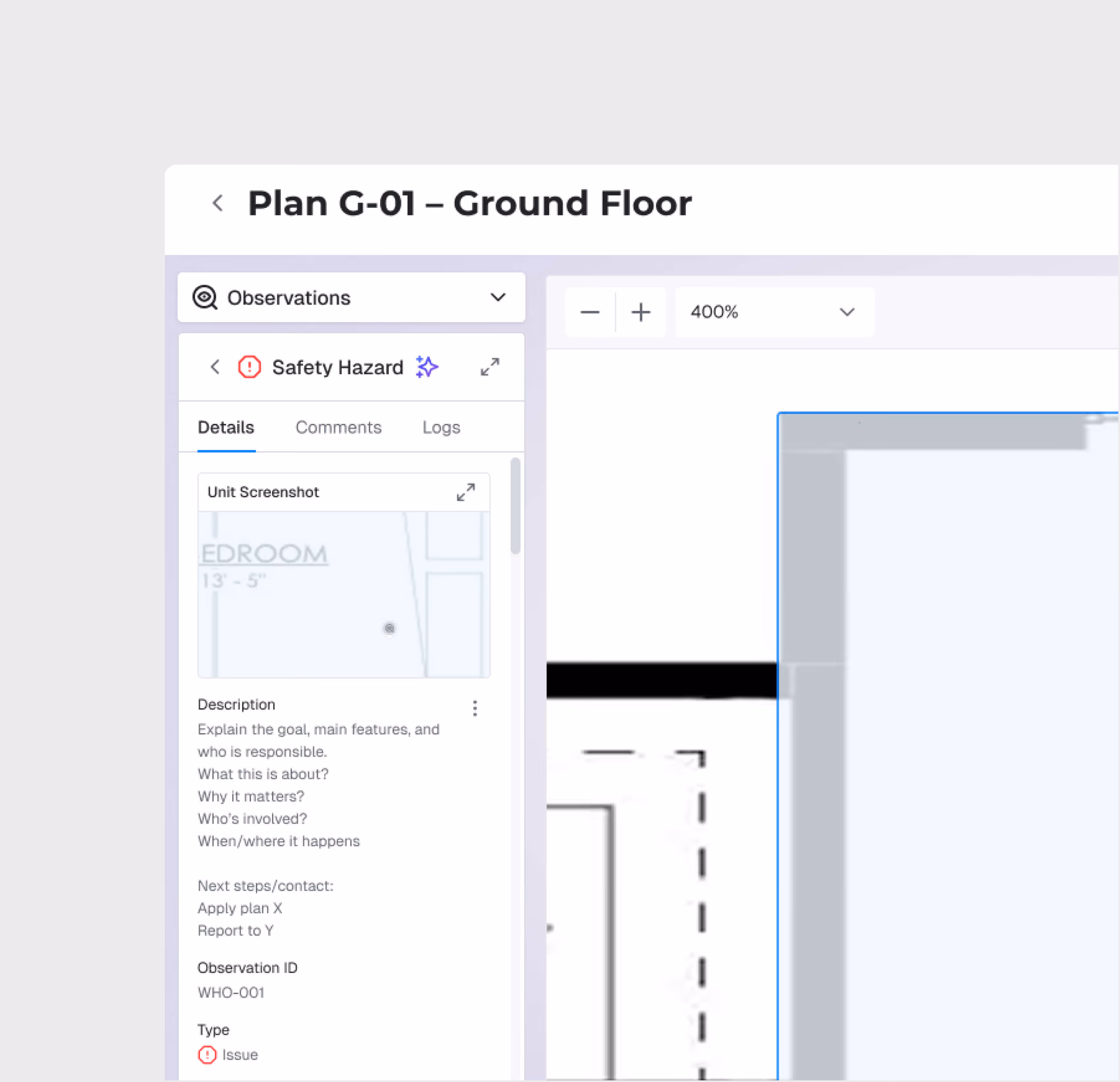
Geo-Tagged Observation Logging
Snagging & Punch List Management
Resolution Tracking Dashboard
Timelapse & BIM Comparison
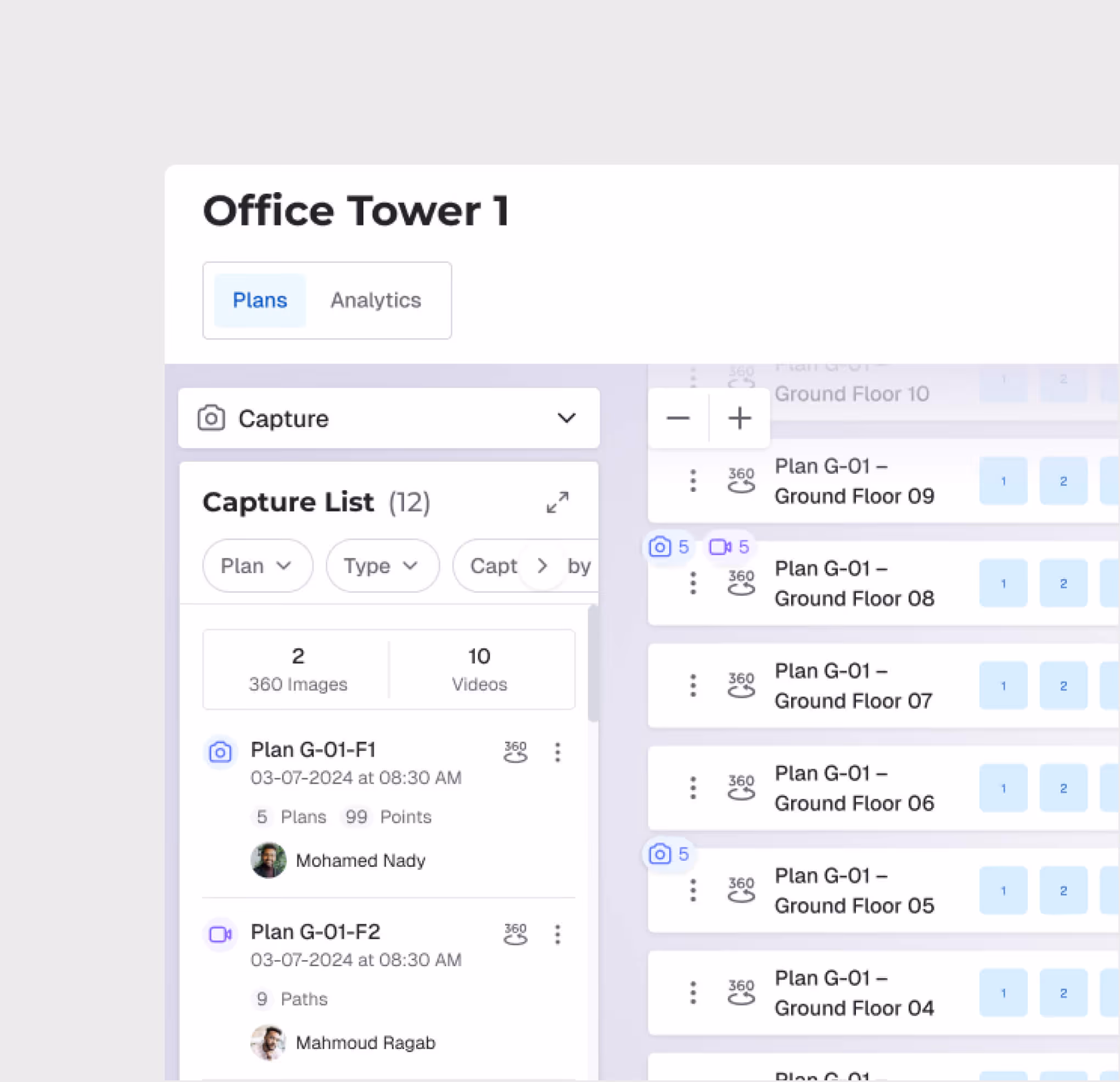
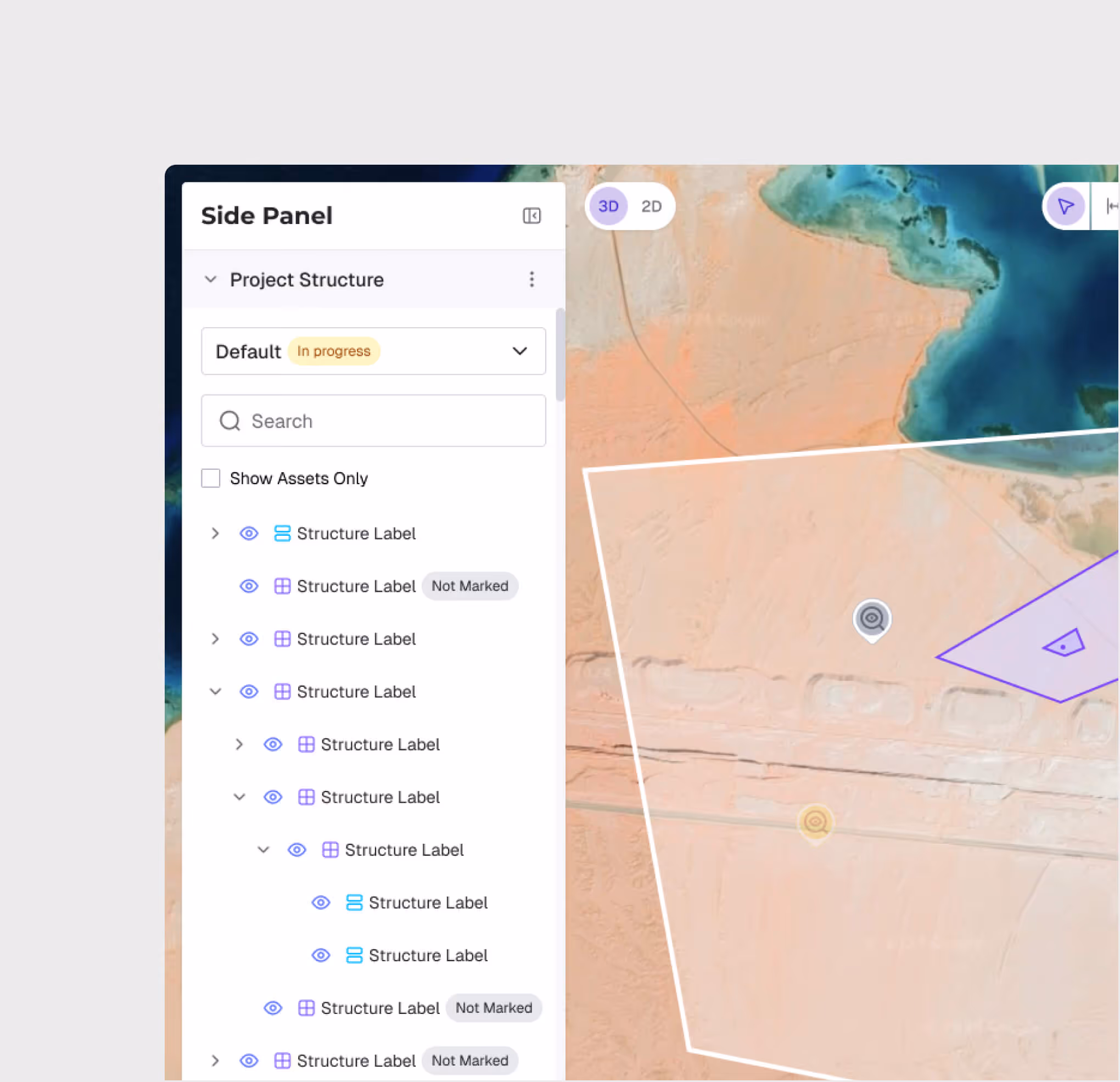
360° Capture Management
Organize site captures by project zones, assets, and dates. Navigate between captures on an interactive floor plan for structured, repeatable documentation across every site visit.
AI-Powered Safety Detection
Upload captures and let AI automatically flag safety issues — before they become incidents.
Virtual Walkthrough
Walk through the site virtually from any device. Stakeholders, consultants, and remote teams can inspect construction quality without traveling to the site.
Geo-Referenced Observation Logging
Log field observations with automatic geo-tagging, photos, and structured categories. Every observation is anchored to a specific location on the project map — tied directly to the corresponding 360 capture.
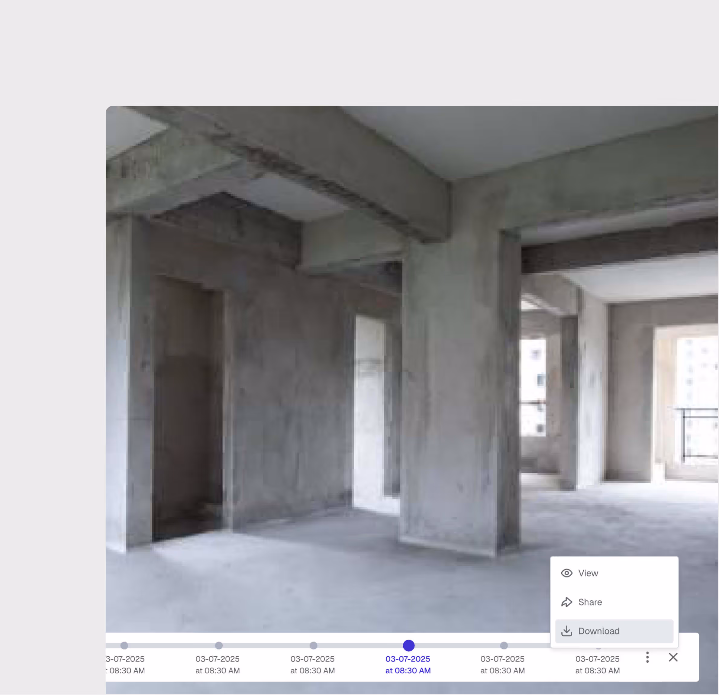
Timelapse, History & Reporting
Build a visual timeline of construction progress. Compare captures across dates, export observation logs as PDF or Excel, and generate analytics on response times, resolution rates, and recurring issue patterns.
Snagging & Punch List Management
Capture defects, snags, and punch list items directly from the field with photos, location tags, and assignee details. Track every item from identification through sign-off — with structured workflows that ensure nothing is handed over incomplete.
360° Reality Capture is most useful for:
Site Supervisors
Structured Site Documentation
Capture 360-degree imagery and log observations during the same site walk — creating a complete visual and issue record without double-entry.
Executives
Virtual Site Inspection
View construction progress from anywhere via virtual walkthroughs, while staying updated on all open observations and their resolution status.
HSE Managers
Safety Observation Tracking
Monitor safety observations tied to specific 360 captures, track resolution rates, and identify recurring hazard patterns with visual evidence.
Project Managers
Issue Resolution Oversight
View all open observations across the project, monitor SLA compliance, and cross-reference with 360 captures to verify resolutions.
QA/QC Teams
Visual Quality Verification
Review construction quality through detailed 360 captures, log defect observations directly from the walkthrough view, and track resolution through closure.
"We used to run separate tools for site photos and issue tracking. Now everything — the walkthroughs, the observations, the snags — lives in one place. Our PM in Riyadh reviews Jeddah site progress every morning and flags issues before our engineers even arrive on site."
.avif)
Frequently asked questions
Yes. Responses can be bookmarked, exported, and shared. Chat history is saved for reference and can be accessed later.
Asif provides source citations with every answer so you can verify accuracy. The quality of responses improves with the quality and completeness of your knowledge base.
Asif connects to the Knowledge Hub (private and public knowledge bases), project documents, and data from other WhiteHelmet modules like cost, schedule, and construction progress.
Asif uses a proprietary AI retrieval-augmented generation (RAG) to search your connected knowledge bases and data sources, then generates answers with direct source citations.
Asif supports English, Hindi, Arabic, Russian, and others, with the ability to understand questions in one language and reference documents in another.
Yes. All geo-referenced detections appear on the GIS map, enabling spatial analysis of environmental conditions across the project.
WhiteHelmet products 360° Reality Capture works well with

Field Intelligence

Project Management Intelligence
Tools that work alongside this product

WhiteHelmet Applications are available in both Google Play and App Store.